Ireland-Day 4
Our plan today was to drive the Ring of Kerry, one of Ireland's most scenic routes. The area is comprised of beautiful mountain and coastal scenery with interesting attractions all along the peninsula. We woke that morning to a dense fog covering the Killareny area. Toni, our hostess at the B&B assured us fog was common and it would lift by mid-morning. After another great breakfast we began our touring.
Rather than the full Irish breakfast I decided to have some porridge. Toni asked if I would like to have it served with Bailey's Irish Cream. I will never eat porridge with just plain milk again. Delicious!
Tried to get a picture of that leprechaun we saw crossing the road.
The colorful town of Sneem is located at the start of the Ring of Kerry. We could see it was still a little foggy so pulled into town to wait for the fog to lift.
Ken tried to visit with this man outside the pub, but he was one of the few Irish people we met who wasn't interested in conversation.
This sign is a good statement of the Irish philosophy on life.
I am always on the lookout for interesting signs. Don't have a clue to the meaning of this one and for some reason I didn't think to ask anyone.
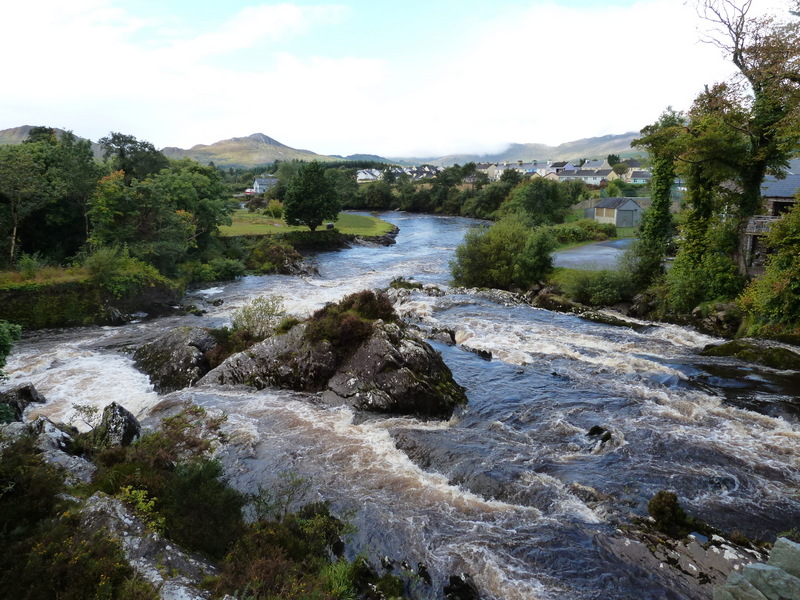
This beautiful river ran through the town dividing the two town center. If you enlarge the picture you can see that the water had a brown tint to it. It was that way throughout most of the country. The water was crystal clear. Not sure if it is from minerals or maybe Guiness runs through the rivers.
Being a Wyoming raised girl you wouldn't think I would have been so impressed with all the sheep. They looked different to me or maybe I was more taken with the gorgeous pastures they were in.
Regardless, I have a lot of sheep pictures (and cows).
Throughout Ireland you will see Ring Forts. This is Staigue Fort, one of the better preserved forts.
Ring Forts stem from the Iron Age and were built to protect against cattle rustlers. People lived inside in huts with underground passages used for storage and refuge.
Some ring forts were in use until late in the 17th century. Promontory ring forts were built on cliffs, using the sea as a natural defence. We would see some later in our trip.
Love this picture of Johnny and Hannah. Wouldn't it look great on a Christmas card.
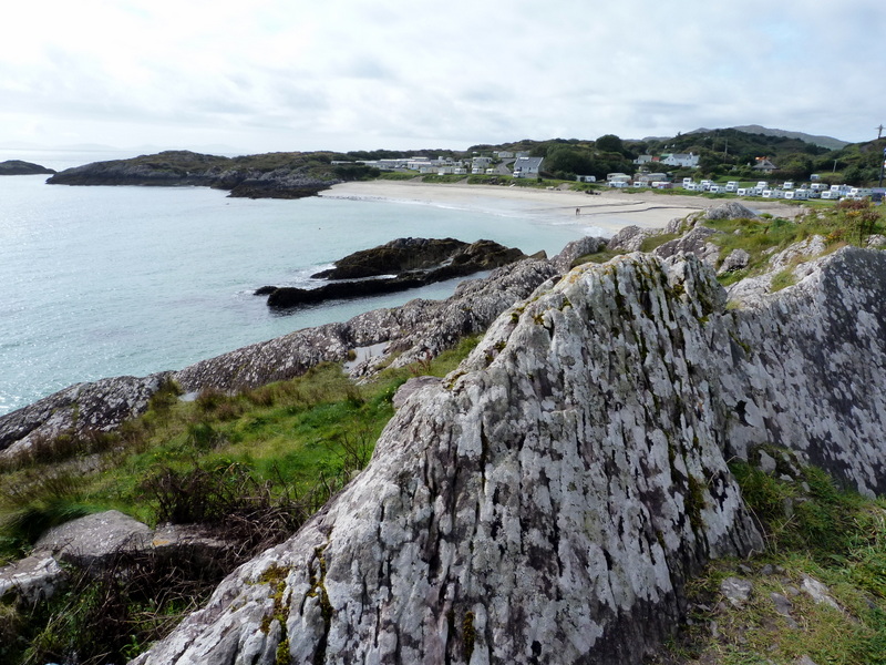
I can't remember the name of this Bay, but it is a resort and vacation area. There was a campground next to the water where camp trailers were parked.
Another one of those narrow roads we often found ourselves on.
We found blackberry bushes at almost every place we stopped.
Heather grows everywhere too.
We spotted this ring fort from a top of hill, but we couldn't see any access road to get down to check it out. It was a little different than Staigue Fort and further into the trip we did see several more like it.
We made a quick stop at the Waterville Golf Course. Ken would love to golf in Ireland some day. The courses were so different from what we are used to and they were also cold and very windy. Waterville has consistently ranked as one of the top courses in Ireland and Great Britain, and was recently rated #34 out of 100 best courses in the world by Golf World magazine.
You would need a lot of golf balls to play these courses. This tall grass would make it almost impossible to find them.
This small building housed both a hardware store and undertaker.
A golf and fishing club- Ken's idea of heaven.
This is an example of the vivid colored hydrangeas we saw throughout out trip.
The next morning we said our goodbyes to Toni and headed for another scenic day trip. This one would be a trip around the Dingle Peninsula and then onto our next stop in Ballybunion.


No comments:
Post a Comment